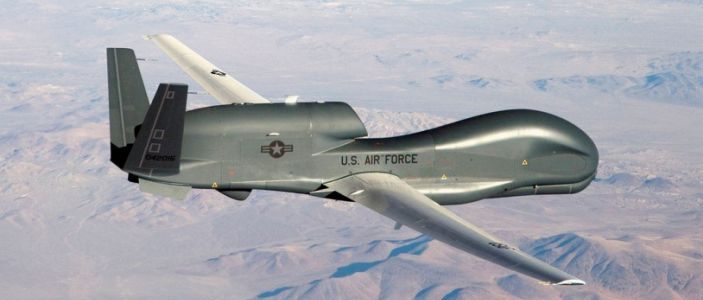
The Air Force is now flying B-1b bombers and Global Hawk spy drones over the South China Sea and other areas within the Pacific theater as part of a broader strategy to sustain surveillance and deterrence missions in the region, following the increased U.S.-Chinese tensions.
The B-1bs are flying out of Guam in support of Indo-Pacific Command and, according to an Air Force report, they are specifically conducting missions over the South China Sea. At the same time, the Air Force is rotating its Global Hawk drones to an Air Base in Japan called Yokota, a move which further bolsters a U.S. operational presence in the region. Such missions are likely taking on a new urgency in light of reports that China has been conducting two-carrier exercises in the South China Sea, something making Taiwan increasingly nervous about a potential Chinese invasion.

The Globalhawk surveillance drones, in tandem with their Guam-based Navy Triton maritime partners, are increasingly engineered with advanced algorithms bringing new levels of autonomy. Pre-programming mission objectives wherein an aircraft can autonomously make adjustments to emerging circumstances and quickly process large volumes of information at one time, allows U.S. Commanders to improve and extend mission scope in the region and possibly overcome the much discussed “tyranny of distance” characterizing the vast, geographically expansive Pacific theater.
One such technical program, engineered for greater airborne autonomy, is called Distributed Autonomy (DARC), enables unmanned systems to better form “mesh” networks through air and ground nodes to perform a greater range of functions without needing to have each small move coordinated by a ground-based human decision-maker. The Northrop made DARC system seeks to distribute greater measures of autonomy into the aircraft itself. “ instead of flying it, you tell it what effect you want in an area,” Scott Winship, Northrop Program Manager, told TNI in an interview.

For example, a Global Hawk could draw upon onboard processing speed to gather, organize and analyze large volumes of ISR data such as video feeds, determine the relevance of specific information and transmit streamlined data to human decision-makers. Better networked aerial surveillance assets can offer another way to address the geographical challenges presented by the Pacific, by enabling drones to exchange data of great relevance across otherwise disparate areas of operation.
“Now our processing capability is so fast and we have so much storage that we are meeting that mission. Algorithms run fast enough so that if we watch our track, it will dump that data if nothing is happening. We only concentrate on the things we want to concentrate on,” Winship explained.
If one drone in a family of interconnected airborne surveillance assets encounters weather obscurants or veers off course, other air “nodes” can help offer direction and enable aircraft to autonomously make the proper adjustments. This not only decreases a “cognitive burden” or human workload, but massively improves latency or combat-critical sensor-to-shooter time.
Much of this is made possible by real-time analytics; for instance, onboard computers can, in some instances, utilize machine learning programs to bounce new mission data off of existing information to make rapid determinations of consequence to a mission before sending organized data to commanders.
In tactical terms, this amounts to having a Globalhawk stare at a strategically relevant portion of the South China Sea and instantly identify moments of importance such as a Chinese surface ship passing through.
“We have finally broken through the barrier of the amount of processing power you can have and get information processing aboard the airplane. We can hit 18 targets in one pass,” Winship added.
Credit: national Interest
